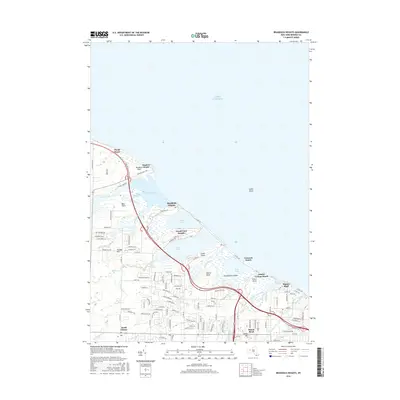
2016 Map of Braddock Heights
USGS Topo · Published 2016About this map
Lake Ontario borders a complex system of barrier ponds and wetlands along the Monroe County shoreline. This landscape is defined by its series of protected water bodies, including Braddock Bay, Cranberry Pond, Long Pond, and Buck Pond, which are separated from the lake by narrow strips of land. These peninsulas host a sequence of distinct residential lakeside communities such as Manitou Beach, Braddock Heights, and Crescent Beach. Further inland, the terrain rises toward Frisbee Hill and transitions into the residential developments of North Greece and Paddy Hill. The Lake Ontario State Pkwy serves as a primary arterial route, cutting across the marshy lowlands formed by Salmon Creek and Buttonwood Creek. The map provides a precise look at the suburban expansion of the town of Greece as it integrates with the natural drainage systems of Round Pond Creek and Slater Creek near the prominent Rigney Bluff.
Find a feature on this map
123 named features on this map. Tap any name to fly to it.
Don’t see what you’re looking for? This feature index may not catch every label — zoom into the map to look around manually.
Map Details
Editions of this 2016 Braddock Heights Map
This is the sole edition of this map. No revisions or reprints were ever made.
Other maps of this area

1895 · Rochester
USGS Topo · 1:62,500

1895 · Ontario Beach
USGS Topo · 1:62,500

1898 · Rochester
USGS Topo · 1:62,500

1899 · Hamlin
USGS Topo · 1:62,500

1899 · Ontario Beach
USGS Topo · 1:62,500

1899 · Brockport
USGS Topo · 1:62,500

1912 · Rochester
USGS Topo · 1:62,500

1912 · Ontario Beach
USGS Topo · 1:62,500

1920 · Rochester
USGS Topo · 1:62,500

1931 · Rochester West
USGS Topo · 1:24,000