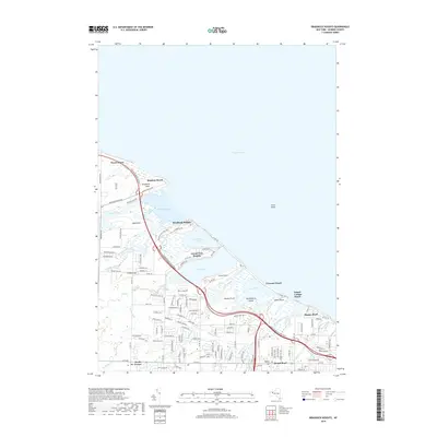
2019 Map of Braddock Heights
USGS Topo · Published 2019About this map
Lake Ontario defines the northern edge of this coastal landscape, where a series of prominent bays and ponds shape the residential and ecological character of the shoreline. The Lake Ontario State Pkwy serves as the primary artery connecting the various waterfront communities, including Braddock Heights, Grand View Heights, and Crescent Beach. These settlements are situated on narrow strips of land between the open lake and interior wetlands like Braddock Bay, Cranberry Pond, and Long Pond. Further inland, the terrain rises toward Frisbee Hill and the community of North Greece. This map reveals a complex network of creeks, such as Salmon Creek, Buttonwood Creek, and Northrup Creek, which drain into the marshy lagoons. Smaller residential clusters like Island Cottage Beach and Payne Beach highlight the area's development as a series of distinct lakeside neighborhoods separated by significant natural water bodies and points like Braddock Point and Beatty Point.
Find a feature on this map
126 named features on this map. Tap any name to fly to it.
Don’t see what you’re looking for? This feature index may not catch every label — zoom into the map to look around manually.
Map Details
Editions of this 2019 Braddock Heights Map
This is the sole edition of this map. No revisions or reprints were ever made.
Other maps of this area

1895 · Rochester
USGS Topo · 1:62,500

1895 · Ontario Beach
USGS Topo · 1:62,500

1898 · Rochester
USGS Topo · 1:62,500

1899 · Hamlin
USGS Topo · 1:62,500

1899 · Ontario Beach
USGS Topo · 1:62,500

1899 · Brockport
USGS Topo · 1:62,500

1912 · Rochester
USGS Topo · 1:62,500

1912 · Ontario Beach
USGS Topo · 1:62,500

1920 · Rochester
USGS Topo · 1:62,500

1931 · Rochester West
USGS Topo · 1:24,000