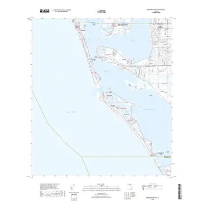
2018 Map of Bradenton Beach
USGS Topo · Published 2018About this map
Anna Maria Island and the northern reaches of Longboat Key dominate this coastal survey, where the barrier islands protect the waters of Anna Maria Sound and Sarasota Bay. Two critical spans, the Anna Maria Bridge and the Cortez Bridge, connect the mainland to the coastal settlements of Bradenton Beach and Holmes Beach. The historic fishing village of Cortez sits prominently on the eastern shore of the Intracoastal Waterway, maintaining its distinct identity apart from the mainland development of Bradenton.
Find a feature on this map
110 named features on this map. Tap any name to fly to it.
Don’t see what you’re looking for? This feature index may not catch every label — zoom into the map to look around manually.
Map Details
Editions of this 2018 Bradenton Beach Map
This is the sole edition of this map. No revisions or reprints were ever made.
Other maps of this area

1921 · Fort De Soto
USGS Topo · 1:62,500

1944 · Egmont Key
USGS Topo · 1:31,680

1944 · Sarasota
USGS Topo · 1:31,680

1944 · Anna Maria
USGS Topo · 1:31,680

1944 · Ellenton
USGS Topo · 1:31,680

1944 · Bradenton Beach
USGS Topo · 1:31,680

1947 · Bradenton
USGS Topo · 1:24,000

1956 · Tampa
USGS Topo · 1:250,000

1959 · Tampa
USGS Topo · 1:250,000

1960 · Tampa
USGS Topo · 1:250,000
Featured Places
- Bradenton, FL
- Longboat Key, FL
- Holmes Beach, FL
- Bradenton Beach, Brandenton Beach
- Longbeach, Longboat Key