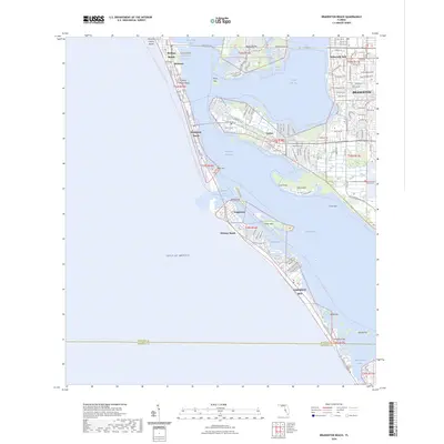
2024 Map of Bradenton Beach
USGS Topo · Published 2024About this map
Anna Maria Island and the neighboring keys define this coastal landscape, where the Gulf of Mexico meets the complex waterways of Anna Maria Sound and Sarasota Bay. The map highlights the modern development patterns of Bradenton Beach and Holmes Beach alongside the mainland reach of Bradenton and Palma Sola Park. A significant interpretive detail is the presence of the Florida Circumnavigational Paddling Trl and the Manatee County Blueway Trl, which follow the Intracoastal Waterway and the edges of islands like Perico Island. These trails reflect the area's contemporary focus on eco-tourism and waterborne recreation. Further south, the map details the narrow northern stretch of Longboat Key, featuring settlements like Longbeach and Whitney Beach separated by the deep channel of Longboat Pass.
Find a feature on this map
118 named features on this map. Tap any name to fly to it.
Don’t see what you’re looking for? This feature index may not catch every label — zoom into the map to look around manually.
Map Details
Editions of this 2024 Bradenton Beach Map
This is the sole edition of this map. No revisions or reprints were ever made.
Other maps of this area

1921 · Fort De Soto
USGS Topo · 1:62,500

1944 · Egmont Key
USGS Topo · 1:31,680

1944 · Sarasota
USGS Topo · 1:31,680

1944 · Anna Maria
USGS Topo · 1:31,680

1944 · Ellenton
USGS Topo · 1:31,680

1944 · Bradenton Beach
USGS Topo · 1:31,680

1947 · Bradenton
USGS Topo · 1:24,000

1956 · Tampa
USGS Topo · 1:250,000

1959 · Tampa
USGS Topo · 1:250,000

1960 · Tampa
USGS Topo · 1:250,000
Featured Places
- Bradenton, FL
- Longboat Key, FL
- Holmes Beach, FL
- Bradenton Beach, Brandenton Beach
- Longbeach, Longboat Key