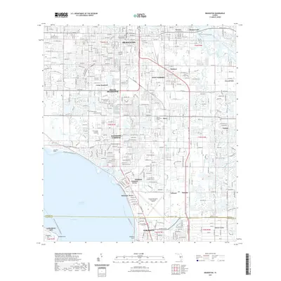
2021 Map of Bradenton
USGS Topo · Published 2021About this map
Bradenton serves as the focal point of this coastal survey, where the urban grid meets the waters of the Intracoastal Waterway and Sarasota Bay. The landscape is defined by its complex hydrology, with Wares Creek and the Braden River carving through established neighborhoods like Samoset and Oneco. Historical landmarks such as Braden Castle and the Manatee County Judicial Center anchor the civic and cultural identity of the area, while modern institutional footprints are seen at the State College of Florida Bradenton and the Sarasota/Bradenton International Airport.
Find a feature on this map
41 named features on this map. Tap any name to fly to it.
Don’t see what you’re looking for? This feature index may not catch every label — zoom into the map to look around manually.
Map Details
Editions of this 2021 Bradenton Map
This is the sole edition of this map. No revisions or reprints were ever made.
Other maps of this area

1921 · Fort De Soto
USGS Topo · 1:62,500

1944 · Sarasota
USGS Topo · 1:31,680

1944 · Anna Maria
USGS Topo · 1:31,680

1944 · Lorraine
USGS Topo · 1:31,680

1944 · Ellenton
USGS Topo · 1:31,680

1944 · Parish
USGS Topo · 1:31,680

1944 · Bradenton Beach
USGS Topo · 1:31,680

1947 · Bradenton
USGS Topo · 1:24,000

1947 · Bee Ridge
USGS Topo · 1:24,000

1956 · Tampa
USGS Topo · 1:250,000