
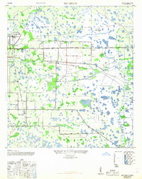
1947 Map of Bee Ridge
USGS Topo · Published 1947About this map
The Ringling Bros Circus Winter Quarters and the Sarasota Municipal Airport anchor the northwestern corner of this Florida landscape, illustrating the region's intersection of tourism and infrastructure in the mid-1940s. Beyond the Sarasota City Limit, the map reveals a mosaic of wetland and prairie typical of the Gulf Coast hinterland, dotted with small communities like Fruitville, Sunnyland, and Bee Ridge.
Find a feature on this map
31 named features on this map. Tap any name to fly to it.
Don’t see what you’re looking for? This feature index may not catch every label — zoom into the map to look around manually.
Map Details
Editions of this 1947 Bee Ridge Map
2 editions found
Other maps of this area

1943 · Laurel
USGS Topo · 1:24,000

1944 · Bird Keys
USGS Topo · 1:31,680

1944 · Sarasota
USGS Topo · 1:31,680

1944 · Lower Myakka Lake
USGS Topo · 1:31,680

1944 · Verna
USGS Topo · 1:31,680

1944 · Laurel
USGS Topo · 1:31,680

1944 · Lorraine
USGS Topo · 1:31,680

1944 · Miakka
USGS Topo · 1:31,680

1947 · Bradenton
USGS Topo · 1:24,000

1956 · Tampa
USGS Topo · 1:250,000