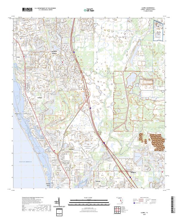
1944 Map of Laurel
USGS Topo · Published 1944About this map
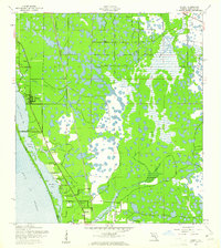
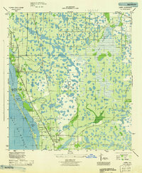
The coastal wetlands and pine flatwoods of Sarasota County are captured here during World War II, a period when the landscape was defined by both traditional settlements and wartime preparation. Near the Gulf of Mexico, the corridor between Vamo and Osprey shows a developing network of roads including the Tamiami Trail and the Blackburn Pt Bridge connecting to Casey Key. Further inland, the presence of the U S Army Bombing Area dominates the central precincts, reflecting the region's strategic military utility during the 1940s.
Find a feature on this map
35 named features on this map. Tap any name to fly to it.
Don’t see what you’re looking for? This feature index may not catch every label — zoom into the map to look around manually.
Map Details
Editions of this 1944 Laurel Map
This is the sole edition of this map. No revisions or reprints were ever made.
Historical Maps of Venice Through Time
9 maps found