
1944 Map of Myakka River
USGS Topo · Published 1944About this map
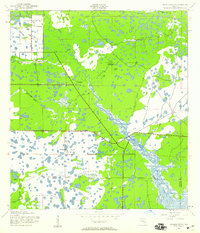
The Myakka River winds through a dense landscape of marsh, swamp, and scattered brush in this wartime survey of Sarasota County. This period is marked by military utility and early regional infrastructure, evidenced by the large Bombing Area situated west of the river. Transport is anchored by the Tamiami Trail and Englewood Road, which intersect near Evans Fishing Camp, a notable riverside landmark for local history.
Find a feature on this map
29 named features on this map. Tap any name to fly to it.
Don’t see what you’re looking for? This feature index may not catch every label — zoom into the map to look around manually.
Map Details
Editions of this 1944 Myakka River Map
2 editions found
Other maps of this area

1943 · Laurel
USGS Topo · 1:24,000

1944 · Lower Myakka Lake
USGS Topo · 1:31,680

1944 · Laurel
USGS Topo · 1:31,680

1944 · Venice
USGS Topo · 1:31,680

1956 · Murdock
USGS Topo · 1:24,000

1956 · Murdock NW
USGS Topo · 1:24,000

1956 · Englewood
USGS Topo · 1:24,000

1956 · Tampa
USGS Topo · 1:250,000

1956 · Charlotte Harbor
USGS Topo · 1:250,000

1957 · Englewood NW
USGS Topo · 1:24,000