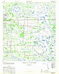
1947 Map of Bee Ridge
USGS Topo · Published 1968About this map
The Ringling Bros Circus Winter Quarters and the Sarasota Municipal Airport anchor the northwestern corner of this Florida landscape, illustrating the regional importance of entertainment and aviation during the post-war period. The map details a transition from the developing edges of the Sarasota City Limit into a rural network of citrus groves and wetlands, defined by the Atlantic Coast Line and Seaboard Air Line railroads. Smaller communities like Fruitville, Bee Ridge, and Sunnyland are mapped with their local infrastructure, including the Bee Ridge Sch, Friendship Ch, and Gillespie School. The eastern portion of the survey is dominated by a sprawling system of lakes and marshes surrounding Cow Pen Slough, while a U S Army Rifle Range and the Bee Ridge Fire Tower serve as distinct navigational landmarks in the interior.
Find a feature on this map
31 named features on this map. Tap any name to fly to it.
Don’t see what you’re looking for? This feature index may not catch every label — zoom into the map to look around manually.
Map Details
Editions of this 1947 Bee Ridge Map
2 editions found
Other maps of this area

1943 · Laurel
USGS Topo · 1:24,000

1944 · Bird Keys
USGS Topo · 1:31,680

1944 · Sarasota
USGS Topo · 1:31,680

1944 · Lower Myakka Lake
USGS Topo · 1:31,680

1944 · Verna
USGS Topo · 1:31,680

1944 · Laurel
USGS Topo · 1:31,680

1944 · Lorraine
USGS Topo · 1:31,680

1944 · Miakka
USGS Topo · 1:31,680

1947 · Bradenton
USGS Topo · 1:24,000

1947 · Bee Ridge
USGS Topo · 1:24,000