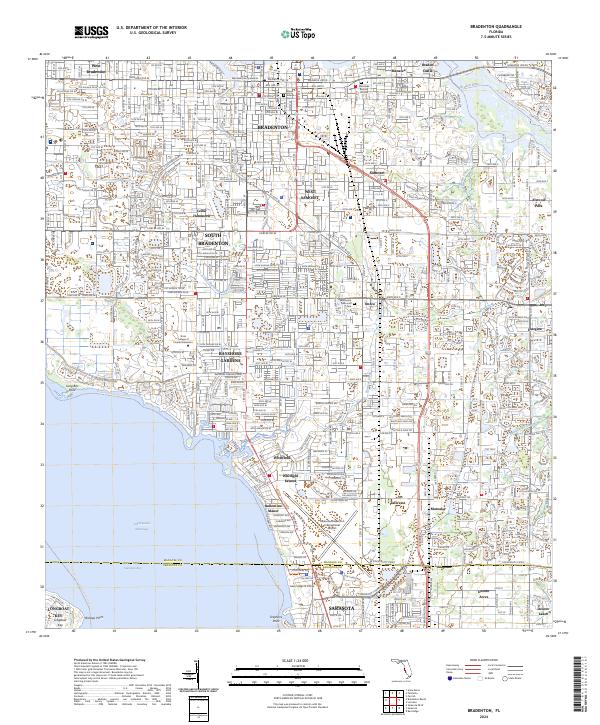
2024 Map of Bradenton
USGS Topo · Published 2024About this map
Bradenton serves as the focal point of this coastal landscape, situated where Wares Creek meets the Manatee River. The map illustrates the dense residential and commercial expansion south toward the Manatee and Sarasota county line, connecting established neighborhoods like West Samoset and South Bradenton. Notable historic sites are anchored in the north, including the ruins at Braden Castle and the Manatee Burying Ground, which provide significant value for local genealogists. The southern portion of the sheet is dominated by the Sarasota/Bradenton International Airport and academic hubs such as the State College of Florida Bradenton and New College of Florida. The intricate network of waterways, including Bowlees Creek and the Pearce Canal, reveals how drainage and navigation systems have shaped the development of communities like Whitfield and Tallevast.
Find a feature on this map
49 named features on this map. Tap any name to fly to it.
Don’t see what you’re looking for? This feature index may not catch every label — zoom into the map to look around manually.
Map Details
Editions of this 2024 Bradenton Map
This is the sole edition of this map. No revisions or reprints were ever made.
Other maps of this area

1921 · Fort De Soto
USGS Topo · 1:62,500

1944 · Sarasota
USGS Topo · 1:31,680

1944 · Anna Maria
USGS Topo · 1:31,680

1944 · Lorraine
USGS Topo · 1:31,680

1944 · Ellenton
USGS Topo · 1:31,680

1944 · Parish
USGS Topo · 1:31,680

1944 · Bradenton Beach
USGS Topo · 1:31,680

1947 · Bradenton
USGS Topo · 1:24,000

1947 · Bee Ridge
USGS Topo · 1:24,000

1956 · Tampa
USGS Topo · 1:250,000