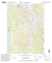
2000 Map of Bradfield Canal B-6
USGS Topo · Published 2003About this map
Tongass National Forest defines the interior landscape of this region, where the glacial and river systems of the Alaska Panhandle carve deep valleys toward the coast. The map illustrates a transitional wilderness at the turn of the millennium, anchored by the Marten Lake Cabin (FS) near the confluence of Marten Lake and Clay Lake. These freshwater systems are hemmed in by steep elevations, including Berg Mountain and the ice of Nelson Glacier in the north.
Find a feature on this map
26 named features on this map. Tap any name to fly to it.
Don’t see what you’re looking for? This feature index may not catch every label — zoom into the map to look around manually.
Map Details
Editions of this 2000 Bradfield Canal B-6 Map
This is the sole edition of this map. No revisions or reprints were ever made.
Other maps of this area

1948 · Petersburg A-1
USGS Topo · 1:63,360

1948 · Petersburg C-1
USGS Topo · 1:63,360

1948 · Petersburg B-1
USGS Topo · 1:63,360

1951 · Bradfield Canal
USGS Topo · 1:250,000

1951 · Petersburg A-1
USGS Topo · 1:63,360

1952 · Petersburg
USGS Topo · 1:250,000

1953 · Petersburg C-1
USGS Topo · 1:63,360

1954 · Bradfield Canal
USGS Topo · 1:250,000

1955 · Bradfield canal A-6
USGS Topo · 1:63,360

1955 · Bradfield canal B-5
USGS Topo · 1:63,360