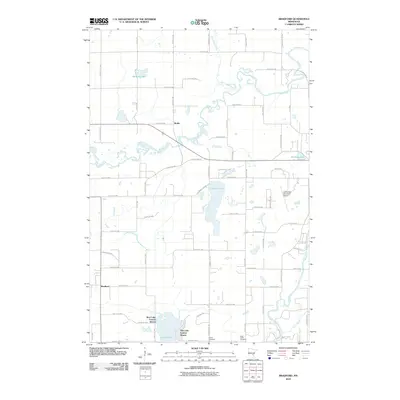
2010 Map of Bradford
USGS Topo · Published 2010About this map
The Rum River winds through Isanti County in this 2010 topographic record, defining the drainage patterns for a landscape dotted with wetlands and small lakes. The small settlement of Bradford anchors the southwestern corner, while Walbo sits further north along the river's bend. This area shows a transition between established rural homesteads and newer residential clusters like West Lake Francis Shores and East Lake Francis Shores surrounding the waters of Lake Francis. Local genealogy and history are preserved at sites like Kienitz Cemetery and Saint Johns Cemetery, which stand alongside the modern infrastructure of the Cambridge Municipal Airport. The map documents a complex network of county roads and named streets that weave through the lowlands created by Stanchfield Creek and Isanti Brook, illustrating how the local geography has dictated the placement of transit and housing.
Find a feature on this map
62 named features on this map. Tap any name to fly to it.
Don’t see what you’re looking for? This feature index may not catch every label — zoom into the map to look around manually.
Map Details
Editions of this 2010 Bradford Map
This is the sole edition of this map. No revisions or reprints were ever made.
Other maps of this area

1916 · St. Francis
USGS Topo · 1:62,500

1919 · St. Francis
USGS Topo · 1:62,500

1953 · Stillwater
USGS Topo · 1:250,000

1955 · Isanti
USGS Topo · 1:62,500

1955 · Stillwater
USGS Topo · 1:250,000

1958 · Stillwater
USGS Topo · 1:250,000

1961 · Bradford
USGS Topo · 1:24,000

1961 · Cambridge
USGS Topo · 1:62,500

1961 · Springvale
USGS Topo · 1:24,000

1961 · Dalbo
USGS Topo · 1:24,000