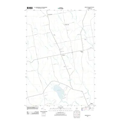
2011 Map of Bradford
USGS Topo · Published 2011About this map
Bradford and its outlying hamlets of Bradford Center and North Bradford are defined by a network of rural roads and branching waterways in this early 21st-century survey. The landscape is heavily influenced by the drainage systems of Mohawk Stream and Forbes Brook, which converge south toward the large expanse of Little Pushaw Pond. For those researching local families, the map identifies several small burial grounds scattered across the countryside, including Hillside Cemetery, Trask Cemetery, and the Williams Cemetery. The presence of Huntington Mill at a junction of streams in the north reflects the long-standing timber and processing history of Penobscot County. Other notable water features like West Branch Dead Stream and Pushaw Stream carve through the wooded terrain, illustrating the hydrologic character that shaped early settlement patterns in this part of Maine.
Find a feature on this map
55 named features on this map. Tap any name to fly to it.
Don’t see what you’re looking for? This feature index may not catch every label — zoom into the map to look around manually.
Map Details
Editions of this 2011 Bradford Map
This is the sole edition of this map. No revisions or reprints were ever made.
Other maps of this area

1902 · Bangor
USGS Topo · 1:62,500

1931 · Stetson
USGS Topo · 1:48,000

1932 · Dover-Foxcroft
USGS Topo · 1:48,000

1933 · Boyd Lake
USGS Topo · 1:62,500

1935 · Dover-Foxcroft
USGS Topo · 1:62,500

1935 · Stetson
USGS Topo · 1:62,500

1942 · Bangor
USGS Topo · 1:62,500

1946 · Bangor
USGS Topo · 1:62,500

1948 · Bangor
USGS Topo · 1:250,000

1951 · Boyd Lake
USGS Topo · 1:50,000