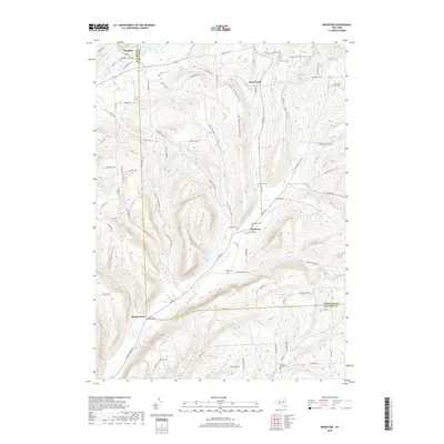
2019 Map of Bradford
USGS Topo · Published 2019About this map
Bradford and Monterey anchor this section of the Southern Tier, where the border of Steuben and Schuyler counties cuts across a landscape of steep ridges and creek valleys. The settlement of Meads Creek sits at a junction in the south, while the N Country National Scenic Trail winds through the central highlands, crossing over Switzer Hill RD and Goundry Hill RD. This modern topography provides an essential record for genealogists, as it identifies numerous small burial sites scattered across the hills.
Find a feature on this map
75 named features on this map. Tap any name to fly to it.
Don’t see what you’re looking for? This feature index may not catch every label — zoom into the map to look around manually.
Map Details
Editions of this 2019 Bradford Map
This is the sole edition of this map. No revisions or reprints were ever made.
Other maps of this area

1895 · Elmira
USGS Topo · 1:62,500

1898 · Watkins Glen
USGS Topo · 1:62,500

1901 · Watkins
USGS Topo · 1:62,500

1903 · Hammondsport
USGS Topo · 1:62,500

1905 · Watkins Glen
USGS Topo · 1:125,000

1914 · Corning
USGS Topo · 1:62,500

1944 · Corning
USGS Topo · 1:62,500

1950 · Elmira
USGS Topo · 1:250,000
1950 · Reading Center
USGS Topo · 1:24,000
1953 · Wayne
USGS Topo · 1:24,000