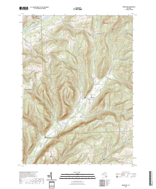
2023 Map of Bradford
USGS Topo · Published 2023About this map
Bradford and its surrounding hill country sit at the convergence of the Steuben Co Schuyler Co line, defined by a landscape of high ridges and narrow hollows. The settlement of Monterey occupies a central valley where Pine Creek and Meads Creek meet, reflecting a traditional Finger Lakes region settlement pattern focused on drainage basins. This modern topographic study reveals a high density of small family and community burial grounds, such as Belmont Cem, Maltby Cem, and Christ Johns Cem, which remain as persistent landmarks across the upland terrain. Long-distance recreation is represented by the North Country National Scenic Trl and Finger Lakes Trl, which wind through the forested heights of Sugar Hill Rd and Goundry Hill Rd. The map also details local water features like Mill Pond and the branching flow of Dry Run, illustrating the enduring intersection of rural road networks and natural hydrology in this part of New York.
Find a feature on this map
78 named features on this map. Tap any name to fly to it.
Don’t see what you’re looking for? This feature index may not catch every label — zoom into the map to look around manually.
Map Details
Editions of this 2023 Bradford Map
This is the sole edition of this map. No revisions or reprints were ever made.
Other maps of this area

1895 · Elmira
USGS Topo · 1:62,500

1898 · Watkins Glen
USGS Topo · 1:62,500

1901 · Watkins
USGS Topo · 1:62,500

1903 · Hammondsport
USGS Topo · 1:62,500

1905 · Watkins Glen
USGS Topo · 1:125,000

1914 · Corning
USGS Topo · 1:62,500

1944 · Corning
USGS Topo · 1:62,500

1950 · Elmira
USGS Topo · 1:250,000
1950 · Reading Center
USGS Topo · 1:24,000
1953 · Wayne
USGS Topo · 1:24,000