
1973 Map of Bradley
USGS Topo · Published 1976About this map
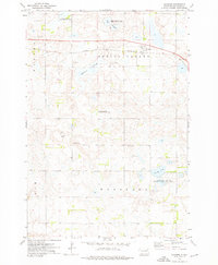
Bradley serves as the primary rail hub on this prairie landscape, where the Chicago Milwaukee St Paul and Pacific crosses the Chicago and North Western line. This 1970s survey captures a geography defined by the glacial depressions of Spring Valley, dotted with numerous small wetlands and larger bodies like Cottonwood Lake and Reid Lake. The map reveals a highly structured agricultural and conservation landscape, characterized by numerous National Waterfowl Production Areas and state-managed grounds like the Bradley State Public Shooting Area. Local civic life is anchored at the Townhall in Thorp and the rural Calvary Ch, while the presence of several Gravel Pits suggests the localized extraction industries supporting the county's road and rail infrastructure.
Find a feature on this map
17 named features on this map. Tap any name to fly to it.
Don’t see what you’re looking for? This feature index may not catch every label — zoom into the map to look around manually.
Map Details
Editions of this 1973 Bradley Map
This is the sole edition of this map. No revisions or reprints were ever made.
Other maps of this area

1953 · Milbank
USGS Topo · 1:250,000

1953 · Watertown
USGS Topo · 1:250,000

1958 · Milbank
USGS Topo · 1:250,000

1958 · Watertown
USGS Topo · 1:250,000

1973 · Lily
USGS Topo · 1:24,000

1973 · Swan Lake
USGS Topo · 1:24,000

1973 · Lone Tree Lake
USGS Topo · 1:24,000

1973 · Heggs Lake
USGS Topo · 1:24,000
1973 · Crocker
USGS Topo · 1:24,000
1973 · Baileys Lake
USGS Topo · 1:24,000