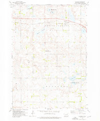
1973 Map of Crocker
USGS Topo · Published 1976About this map
The prairie landscape of Spring Valley and Woodland townships is defined by the ephemeral water patterns of the eastern Dakotas. The Chicago and North Western railroad bisects the northern half of the region, passing through the small community of Crocker. To the south and west, the terrain is dotted with significant wetland features including Mallard Slough, Twin Sloughs, and Round Lake.
Find a feature on this map
20 named features on this map. Tap any name to fly to it.
Don’t see what you’re looking for? This feature index may not catch every label — zoom into the map to look around manually.
Map Details
Editions of this 1973 Crocker Map
This is the sole edition of this map. No revisions or reprints were ever made.
Other maps of this area

1953 · Milbank
USGS Topo · 1:250,000

1953 · Watertown
USGS Topo · 1:250,000

1958 · Milbank
USGS Topo · 1:250,000

1958 · Watertown
USGS Topo · 1:250,000
1958 · Crandall
USGS Topo · 1:24,000
1973 · Crocker SW
USGS Topo · 1:24,000

1973 · Lily
USGS Topo · 1:24,000

1973 · Bradley
USGS Topo · 1:24,000

1973 · Lone Tree Lake
USGS Topo · 1:24,000
1973 · Baileys Lake
USGS Topo · 1:24,000