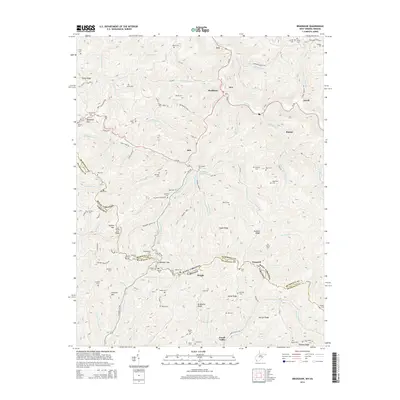
2014 Map of Bradshaw
USGS Topo · Published 2014About this map
Bradshaw and the surrounding coal country of McDowell County are defined by deep-cut watercourses like Dry Fork and Bradshaw Cr, which dictate the placement of settlements and roads in this Appalachian terrain. Along the southern edge, the high boundary of State Line Ridge separates West Virginia from Virginia, where the community of Jewell Valley sits near the headwaters of Dismal Cr. This 2014 survey records a landscape heavily populated with small family and community burial grounds, such as Estep Cem, Vance Cem, and Buckeye Cem, often located on ridges or benches above the valley floor. The geography shows a dense network of mountain hollows like Buckeye Hollow Rd and Hagerman Branch, illustrating how local topography has historically isolated and shaped the small communities of Jolo, Raysal, and Peapatch.
Find a feature on this map
88 named features on this map. Tap any name to fly to it.
Don’t see what you’re looking for? This feature index may not catch every label — zoom into the map to look around manually.
Map Details
Editions of this 2014 Bradshaw Map
This is the sole edition of this map. No revisions or reprints were ever made.
Other maps of this area

1891 · Tazewell
USGS Topo · 1:125,000

1895 · Tazewell
USGS Topo · 1:125,000

1897 · Tazewell
USGS Topo · 1:125,000

1910 · Iaeger
USGS Topo · 1:48,000

1912 · Pounding Mill
USGS Topo · 1:62,500

1912 · Iaeger
USGS Topo · 1:62,500

1912 · Welch
USGS Topo · 1:62,500

1914 · Iaeger
USGS Topo · 1:48,000

1915 · Richlands
USGS Topo · 1:48,000

1916 · Pounding Mill
USGS Topo · 1:62,500