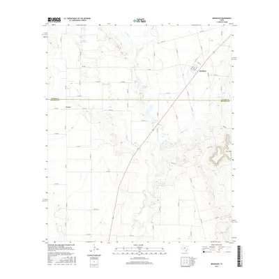
2016 Map of Bradshaw
USGS Topo · Published 2016About this map
Bradshaw and the smaller settlement of Drasco anchor this portion of the Texas landscape, situated along the county line where Taylor Co meets Runnels Co. The terrain is defined by the prominent Moro Mtn to the southeast and a network of ephemeral waterways that feed the region's ranching and agricultural interests. Water management is central to the area's geography, visible in features like the Bluff Cr Reservoir and Downing Lake. A dense network of county roads, including Co RD 186 and Co RD 200, crisscross the plains, while US Route 83 provides the primary north-south transit corridor through the heart of the territory. The map illustrates a rural Texas environment where drainage patterns from Bulger Cr, Mill Cr, and Salt Br dictate the placement of local homesteads and access routes.
Find a feature on this map
58 named features on this map. Tap any name to fly to it.
Don’t see what you’re looking for? This feature index may not catch every label — zoom into the map to look around manually.
Map Details
Editions of this 2016 Bradshaw Map
This is the sole edition of this map. No revisions or reprints were ever made.
Other maps of this area

1890 · Abilene
USGS Topo · 1:125,000

1891 · Hayrick
USGS Topo · 1:125,000

1892 · Abilene
USGS Topo · 1:125,000

1892 · Ballinger
USGS Topo · 1:125,000

1893 · Sweetwater
USGS Topo · 1:125,000

1894 · Hayrick
USGS Topo · 1:125,000

1954 · Brownwood
USGS Topo · 1:250,000

1954 · Big Spring
USGS Topo · 1:250,000

1954 · Abilene
USGS Topo · 1:250,000

1954 · San Angelo
USGS Topo · 1:250,000