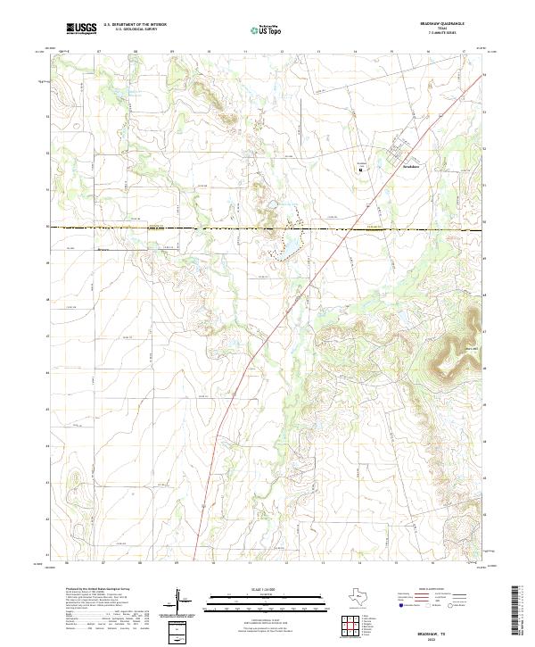
2022 Map of Bradshaw
USGS Topo · Published 2022About this map
Bradshaw and Drasco anchor this West Texas landscape where the high plains begin to break toward the Colorado River watershed. The terrain is defined by a dense network of seasonal drainages, including Bluff Cr, Mill Cr, and Bulger Cr, which carve through the limestone-capped country. Near the center of the sheet, the Bluff Cr Reservoir and Downing Lake provide critical water management in an area dominated by cattle ranching and dry-land farming. Local history is grounded at the Bradshaw Cem, while the prominent Moro Mtn rises in the southeast, serving as a significant topographic landmark. The map details the transition between Taylor Co and Runnels Co, showing how modern county roads like FM 1086 and the Mopr Rd corridor follow the natural contours of the land established by early settlers.
Find a feature on this map
58 named features on this map. Tap any name to fly to it.
Don’t see what you’re looking for? This feature index may not catch every label — zoom into the map to look around manually.
Map Details
Editions of this 2022 Bradshaw Map
This is the sole edition of this map. No revisions or reprints were ever made.
Other maps of this area

1890 · Abilene
USGS Topo · 1:125,000

1891 · Hayrick
USGS Topo · 1:125,000

1892 · Abilene
USGS Topo · 1:125,000

1892 · Ballinger
USGS Topo · 1:125,000

1893 · Sweetwater
USGS Topo · 1:125,000

1894 · Hayrick
USGS Topo · 1:125,000

1954 · Brownwood
USGS Topo · 1:250,000

1954 · Big Spring
USGS Topo · 1:250,000

1954 · Abilene
USGS Topo · 1:250,000

1954 · San Angelo
USGS Topo · 1:250,000