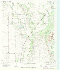
1967 Map of Bradshaw
USGS Topo · Published 1971About this map
The Abilene and Southern railroad cuts a diagonal line across this West Texas landscape, connecting the small settlement of Bradshaw to the surrounding ranching and oil country. Located on the Taylor Co / Runnels Co line, the area shows a distinct pattern of petroleum exploration, with numerous Oil Wells scattered across the plains and near the base of Moro Mountain. The terrain is defined by the drainage systems of Bluff Creek and Mill Creek, which carve through the relatively flat elevations.
Find a feature on this map
17 named features on this map. Tap any name to fly to it.
Don’t see what you’re looking for? This feature index may not catch every label — zoom into the map to look around manually.
Map Details
Editions of this 1967 Bradshaw Map
This is the sole edition of this map. No revisions or reprints were ever made.
Other maps of this area

1890 · Abilene
USGS Topo · 1:125,000

1891 · Hayrick
USGS Topo · 1:125,000

1892 · Abilene
USGS Topo · 1:125,000

1892 · Ballinger
USGS Topo · 1:125,000

1893 · Sweetwater
USGS Topo · 1:125,000

1894 · Hayrick
USGS Topo · 1:125,000

1954 · Brownwood
USGS Topo · 1:250,000

1954 · Big Spring
USGS Topo · 1:250,000

1954 · Abilene
USGS Topo · 1:250,000

1954 · San Angelo
USGS Topo · 1:250,000