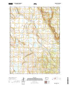
2020 Map of Brady Butte
USGS Topo · Published 2020About this map
Antelope Flat and the surrounding high desert terrain define this corner of Klamath County, where water management is the dominant feature of the landscape. Numerous artificial impoundments, including the large Willow Valley Reservoir and Gerber Lower Division Reservoir, signify the region's historical reliance on seasonal water storage. The topography is marked by distinctive formations such as The Bumpheads, Horse Camp Rim, and the prominent Brady Butte.
Find a feature on this map
37 named features on this map. Tap any name to fly to it.
Don’t see what you’re looking for? This feature index may not catch every label — zoom into the map to look around manually.
Map Details
Editions of this 2020 Brady Butte Map
This is the sole edition of this map. No revisions or reprints were ever made.
Other maps of this area

1886 · Alturas
USGS Topo · 1:250,000

1886 · Modoc Lava Bed
USGS Topo · 1:250,000

1889 · Klamath
USGS Topo · 1:250,000

1892 · Modoc Lava-Bed
USGS Topo · 1:250,000

1892 · Alturas
USGS Topo · 1:250,000

1894 · Klamath
USGS Topo · 1:250,000

1951 · Clear Lake Reservoir
USGS Topo · 1:62,500

1954 · Alturas
USGS Topo · 1:250,000

1955 · Klamath Falls
USGS Topo · 1:250,000

1958 · Alturas
USGS Topo · 1:250,000