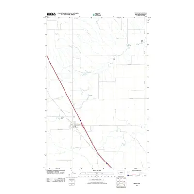
2011 Map of Brady
USGS Topo · Published 2011About this map
The town of Brady sits at the center of this agricultural landscape in Pondera County, Montana. As a vital hub for the surrounding plains, the settlement is anchored by the Brady Post Office and local emergency services, including the Pondera Co Rural Fire Dist Sta 1 and the Brady Vol Fire Dept. The terrain is defined by a series of water management features essential for prairie life, notably South Rigby Dam and Rigby Dam in the northeast, along with Kauk Dam and Otilalda Dam situated further west. These structures interact with the natural drainage of Brady Coulee. A network of section-line roads, such as Chance Rd and Circle S Rd, divides the territory into a geometric grid typical of the Great Plains, while Hwy 91 South provides a primary transit corridor through the region.
Find a feature on this map
24 named features on this map. Tap any name to fly to it.
Don’t see what you’re looking for? This feature index may not catch every label — zoom into the map to look around manually.
Map Details
Editions of this 2011 Brady Map
This is the sole edition of this map. No revisions or reprints were ever made.
Other maps of this area

1886 · Great Falls
USGS Topo · 1:250,000

1920 · Conrad
USGS Topo · 1:125,000

1950 · Dutton
USGS Topo · 1:62,500

1950 · Collins
USGS Topo · 1:62,500

1954 · Great Falls
USGS Topo · 1:250,000

1954 · Shelby
USGS Topo · 1:250,000

1957 · Great Falls
USGS Topo · 1:250,000

1958 · Shelby
USGS Topo · 1:250,000
1967 · Conrad
USGS Topo · 1:24,000

1967 · Brady
USGS Topo · 1:24,000