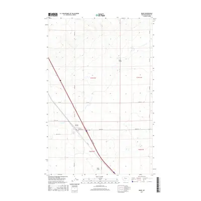
2017 Map of Brady
USGS Topo · Published 2017About this map
Brady sits at the heart of this Pondera County landscape, where the intersection of Central Ave E and 1st Ave N defines the small town's grid. The surrounding area is marked by a strict section-line road network, indicating the deep influence of the Public Land Survey System on Montana's agricultural development. Primary transportation corridors like Hwy 91 S and the Brady Frontage run northwest-to-southeast, cutting diagonally across the landscape and paralleling the drainage patterns of Brady Coulee and Rocky Coulee. Local routes such as Arod Lakes Rd and Lazy E Rd connect the town to the broader plains, providing a look at the rural connectivity and land divisions that have shaped the region into the 21st century.
Find a feature on this map
21 named features on this map. Tap any name to fly to it.
Don’t see what you’re looking for? This feature index may not catch every label — zoom into the map to look around manually.
Map Details
Editions of this 2017 Brady Map
This is the sole edition of this map. No revisions or reprints were ever made.
Other maps of this area

1886 · Great Falls
USGS Topo · 1:250,000

1920 · Conrad
USGS Topo · 1:125,000

1950 · Dutton
USGS Topo · 1:62,500

1950 · Collins
USGS Topo · 1:62,500

1954 · Great Falls
USGS Topo · 1:250,000

1954 · Shelby
USGS Topo · 1:250,000

1957 · Great Falls
USGS Topo · 1:250,000

1958 · Shelby
USGS Topo · 1:250,000
1967 · Conrad
USGS Topo · 1:24,000

1967 · Brady
USGS Topo · 1:24,000