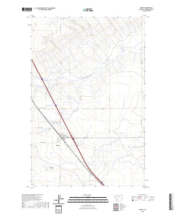
2024 Map of Brady
USGS Topo · Published 2024About this map
Brady serves as the central hub of this Pondera County landscape, situated at the intersection of local routes and the modern highway corridor. The town layout is defined by its grid, featuring Central Ave E, Marriott St, and 1st Ave N. The surrounding terrain is deeply marked by the hydrology of the plains, where the South Pondera Coulee, Brady Coulee, and Rocky Coulee carve paths across the township boundaries. These coulees represent the primary topographic relief in an area otherwise dominated by the systematic sections of the Public Land Survey System.
Find a feature on this map
23 named features on this map. Tap any name to fly to it.
Don’t see what you’re looking for? This feature index may not catch every label — zoom into the map to look around manually.
Map Details
Editions of this 2024 Brady Map
This is the sole edition of this map. No revisions or reprints were ever made.
Other maps of this area

1886 · Great Falls
USGS Topo · 1:250,000

1920 · Conrad
USGS Topo · 1:125,000

1950 · Dutton
USGS Topo · 1:62,500

1950 · Collins
USGS Topo · 1:62,500

1954 · Great Falls
USGS Topo · 1:250,000

1954 · Shelby
USGS Topo · 1:250,000

1957 · Great Falls
USGS Topo · 1:250,000

1958 · Shelby
USGS Topo · 1:250,000
1967 · Conrad
USGS Topo · 1:24,000

1967 · Brady
USGS Topo · 1:24,000