
1967 Map of Brady
USGS Topo · Published 1970About this map
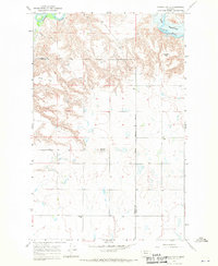
The settlement of Brady serves as the focal point of this 1967 survey, situated along the Great Northern railroad line in Pondera County. This prairie landscape is defined by its agricultural and industrial infrastructure, where the rail line runs parallel to the Lewis and Clark Trail, connecting local commerce to the broader region. The map reveals a specialized local economy, highlighting Storage Bins, a Water Tank, and nearby Oil Wells that speak to the dual importance of grain handling and mineral extraction in the mid-20th century. The terrain is marked by the winding paths of South Pondera Coulee and Rocky Coulee, which cut through the high plains. Small aviation facilities like the Landing Strip north of the town site reflect the logistical needs of this expansive Montana landscape.
Find a feature on this map
11 named features on this map. Tap any name to fly to it.
Don’t see what you’re looking for? This feature index may not catch every label — zoom into the map to look around manually.
Map Details
Editions of this 1967 Brady Map
This is the sole edition of this map. No revisions or reprints were ever made.
Other maps of this area

1886 · Great Falls
USGS Topo · 1:250,000

1920 · Conrad
USGS Topo · 1:125,000

1950 · Dutton
USGS Topo · 1:62,500

1950 · Collins
USGS Topo · 1:62,500

1954 · Great Falls
USGS Topo · 1:250,000

1954 · Shelby
USGS Topo · 1:250,000

1957 · Great Falls
USGS Topo · 1:250,000

1958 · Shelby
USGS Topo · 1:250,000
1967 · Conrad
USGS Topo · 1:24,000

1967 · Fowler Coulee SW
USGS Topo · 1:24,000