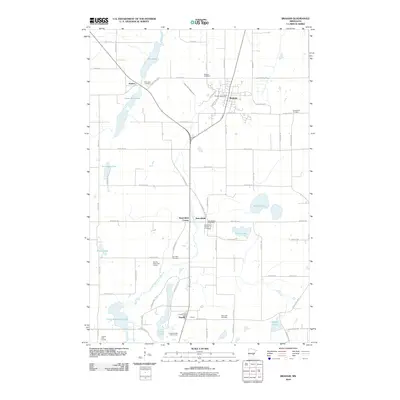
2010 Map of Braham
USGS Topo · Published 2010About this map
Braham stands as the primary hub in this eastern Minnesota landscape, characterized by a transition from wetland systems to established agricultural plots. The town layout is anchored by the Braham Post Office, with residential streets like Elmhurst Ave S and Ferndale Dr S branching out near the rail corridor. To the south, the settlements of Stanchfield and Grandy provide smaller focal points for local commerce, each maintaining its own postal identity.
Find a feature on this map
58 named features on this map. Tap any name to fly to it.
Don’t see what you’re looking for? This feature index may not catch every label — zoom into the map to look around manually.
Map Details
Editions of this 2010 Braham Map
This is the sole edition of this map. No revisions or reprints were ever made.
Other maps of this area

1953 · Stillwater
USGS Topo · 1:250,000

1955 · Stillwater
USGS Topo · 1:250,000

1958 · Stillwater
USGS Topo · 1:250,000

1961 · Bradford
USGS Topo · 1:24,000

1961 · Cambridge
USGS Topo · 1:62,500

1961 · Brook Park
USGS Topo · 1:62,500

1961 · Springvale
USGS Topo · 1:24,000

1961 · Dalbo
USGS Topo · 1:62,500

1965 · Stillwater
USGS Topo · 1:250,000
1968 · Mora South
USGS Topo · 1:24,000