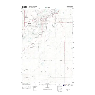
2013 Map of Brainerd
USGS Topo · Published 2013About this map
The Mississippi River defines the landscape of central Minnesota in this 2013 survey, flowing through the heart of Brainerd and Baxter. The city's northern reaches are marked by the presence of Evergreen Cem and Lum Park Campground, while the southern corridor follows the winding course of the river past First Island. To the east, the terrain transitions into the Cuyuna Range, a region defined by its complex hydrography including Rice Lake and Whiteley Cr. Institutional and civic landmarks are prominent, from the Central Lakes College-Brainerd campus to the Crow Wing County Fairgrounds. The map also captures the outlying residential developments like Meadow View Manor and the small settlement of Barrows to the southwest, situated near the Jackson Field Airport. This document provides a clear view of the regional road network, including the intersection of MN-210 and MN-371.
Find a feature on this map
127 named features on this map. Tap any name to fly to it.
Don’t see what you’re looking for? This feature index may not catch every label — zoom into the map to look around manually.
Map Details
Editions of this 2013 Brainerd Map
This is the sole edition of this map. No revisions or reprints were ever made.
Other maps of this area

1915 · Brainerd
USGS Topo · 1:62,500

1916 · Pillager
USGS Topo · 1:62,500

1918 · Brainerd
USGS Topo · 1:62,500

1919 · Pillager
USGS Topo · 1:62,500

1948 · Belle Prairie
USGS Topo · 1:62,500

1948 · Lastrup
USGS Topo · 1:62,500

1950 · Lastrup
USGS Topo · 1:62,500

1950 · Belle Prairie
USGS Topo · 1:62,500

1953 · Brainerd
USGS Topo · 1:250,000

1954 · Baxter
USGS Topo · 1:24,000
Featured Places
- Brainerd, MN
- Baxter, MN
- Westwood Mobile Home Park, Brainerd
- East Gate Mobile Home Park, Brainerd
- Meadow View Manor, Brainerd