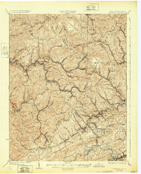
1925 Map of Bramwell
USGS Topo · Published 1932About this map
The Norfolk and Western rail lines dictate the industrial character of this landscape, threading through the valleys of the Bluestone River and Tug Fork. At the height of the coal era, rail infrastructure like the Flattop Yards and numerous spur lines serviced high-density mining settlements including Jenkinjones, Pageton, and Pocahontas. This survey highlights the complex borderland between West Virginia and Virginia, where the ridge-and-valley terrain forced concentrated development along narrow corridors like Flipping Creek and Simmons Creek.
Find a feature on this map
131 named features on this map. Tap any name to fly to it.
Don’t see what you’re looking for? This feature index may not catch every label — zoom into the map to look around manually.
Map Details
Editions of this 1925 Bramwell Map
3 editions found
Other maps of this area

1887 · Pocahontas
USGS Topo · 1:125,000

1891 · Tazewell
USGS Topo · 1:125,000

1891 · Pocahontas
USGS Topo · 1:125,000

1891 · Oceana
USGS Topo · 1:125,000

1891 · Raleigh
USGS Topo · 1:125,000

1893 · Oceana
USGS Topo · 1:125,000

1894 · Pocahontas
USGS Topo · 1:125,000

1895 · Tazewell
USGS Topo · 1:125,000

1895 · Pocahontas
USGS Topo · 1:125,000

1897 · Tazewell
USGS Topo · 1:125,000