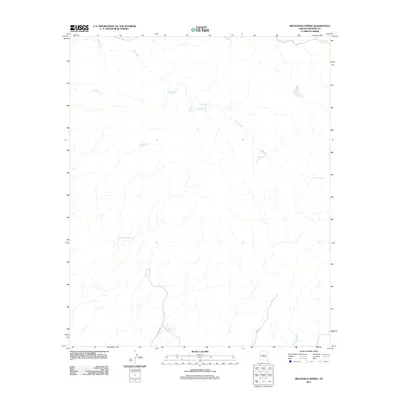
2011 Map of Branaman Spring
USGS Topo · Published 2011About this map
Salt Creek winds through this arid Graham County landscape, providing a primary drainage route for a series of seasonal washes and ephemeral water sources. The terrain is characterized by its vital dependency on small, scattered water points such as Branaman Spring and Cottonwood Spring, which likely served as essential stops for movement through this high desert. The map reveals a network of man-made water catchments, including Branaman Tank and Lost Man Tank, illustrating the ranching and resource management necessary to inhabit this region. Access is limited to remote corridors like Indian Rte 240 and Rte 221, which cut through the southern portion of the quadrangle. Other curiously named features, such as No Way Spring and Salt Box Tank, offer clues to the local history and the lived experience of the people who navigated this environment.
Find a feature on this map
13 named features on this map. Tap any name to fly to it.
Don’t see what you’re looking for? This feature index may not catch every label — zoom into the map to look around manually.
Map Details
Editions of this 2011 Branaman Spring Map
This is the sole edition of this map. No revisions or reprints were ever made.
Other maps of this area

1954 · Mesa
USGS Topo · 1:250,000

1957 · Mesa
USGS Topo · 1:250,000

1958 · Mesa
USGS Topo · 1:250,000

1960 · Mesa
USGS Topo · 1:250,000

1960 · Bylas
USGS Topo · 1:62,500

1962 · San Carlos Reservoir
USGS Topo · 1:62,500

1964 · Mesa
USGS Topo · 1:250,000

1965 · Sontag Mesa
USGS Topo · 1:24,000

1966 · Branaman Spring
USGS Topo · 1:24,000
1966 · Bronco Gulch
USGS Topo · 1:24,000