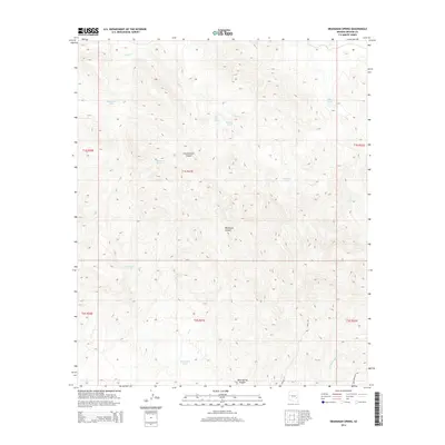
2014 Map of Branaman Spring
USGS Topo · Published 2014About this map
Branaman Spring and Salt Box Spring anchor this Graham County landscape, where water management is the primary marker of human presence. The terrain is defined by deep drainages like Cottonwood Canyon, Wildhorse Canyon, and Bone Spring Canyon, which channel seasonal flows into Salt Cr and Fivemile Wash. A network of catchment basins, including Branaman Tank, Boni Tank, and the curiously named Lost Man Tank, illustrates the vital importance of water storage in this arid region.
Find a feature on this map
22 named features on this map. Tap any name to fly to it.
Don’t see what you’re looking for? This feature index may not catch every label — zoom into the map to look around manually.
Map Details
Editions of this 2014 Branaman Spring Map
This is the sole edition of this map. No revisions or reprints were ever made.
Other maps of this area

1954 · Mesa
USGS Topo · 1:250,000

1957 · Mesa
USGS Topo · 1:250,000

1958 · Mesa
USGS Topo · 1:250,000

1960 · Mesa
USGS Topo · 1:250,000

1960 · Bylas
USGS Topo · 1:62,500

1962 · San Carlos Reservoir
USGS Topo · 1:62,500

1964 · Mesa
USGS Topo · 1:250,000

1965 · Sontag Mesa
USGS Topo · 1:24,000

1966 · Branaman Spring
USGS Topo · 1:24,000
1966 · Bronco Gulch
USGS Topo · 1:24,000