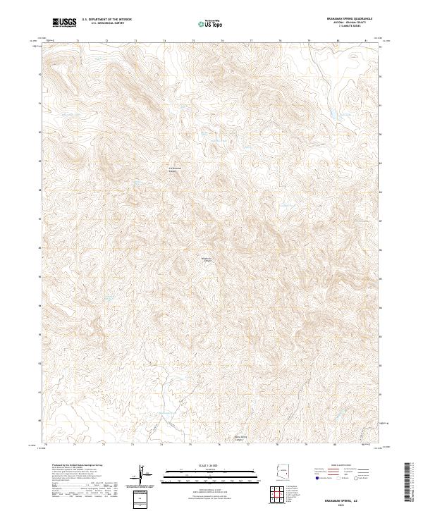
2021 Map of Branaman Spring
USGS Topo · Published 2021About this map
Salt Cr winds through a landscape of deep drainages and intermittent water sources in this Graham County territory. The map reveals a reliance on water management through numerous cattle tanks, including Branaman Tank, Salt Box Tank, Boni Tank, and the isolated Lost Man Tank. These features, coupled with natural water points like Branaman Spring and Cottonwood Spring, suggest a history of ranching and livestock movement through the complex terrain of Wildhorse Canyon and Cottonwood Canyon.
Find a feature on this map
24 named features on this map. Tap any name to fly to it.
Don’t see what you’re looking for? This feature index may not catch every label — zoom into the map to look around manually.
Map Details
Editions of this 2021 Branaman Spring Map
This is the sole edition of this map. No revisions or reprints were ever made.
Other maps of this area

1954 · Mesa
USGS Topo · 1:250,000

1957 · Mesa
USGS Topo · 1:250,000

1958 · Mesa
USGS Topo · 1:250,000

1960 · Mesa
USGS Topo · 1:250,000

1960 · Bylas
USGS Topo · 1:62,500

1962 · San Carlos Reservoir
USGS Topo · 1:62,500

1964 · Mesa
USGS Topo · 1:250,000

1965 · Sontag Mesa
USGS Topo · 1:24,000

1966 · Branaman Spring
USGS Topo · 1:24,000
1966 · Bronco Gulch
USGS Topo · 1:24,000