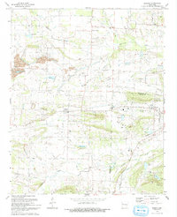
1993 Map of Branch
USGS Topo · Published 1993About this map
Branch sits as a central hub on this 1990s survey, illustrating the convergence of agricultural land and industrial activity in the Franklin and Logan County borderlands. The landscape is defined by its water management and extraction history, visible in the numerous numbered reservoirs like Lake No 24 and the extensive Strip Mine operations that have reshaped the terrain north of the town center. Local genealogy is anchored by a significant density of family and community landmarks, from the County Line High Sch to numerous small burial grounds including Hunter Cem and Boydston Cem. The southern reach of the map transitions into the more varied topography of Metcalf Hill and Bee Mountain, where the drainage of Sixmile Creek and Dry Fork carves through the countryside. Small religious centers like Coles Chapel and Brooklyn Ch provide a clear view of the rural settlement patterns that persisted in this part of Arkansas into the late twentieth century.
Find a feature on this map
52 named features on this map. Tap any name to fly to it.
Don’t see what you’re looking for? This feature index may not catch every label — zoom into the map to look around manually.
Map Details
Editions of this 1993 Branch Map
This is the sole edition of this map. No revisions or reprints were ever made.
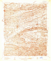
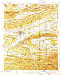
Other maps of this area

1887 · Magazine Mountain #2
USGS Topo · 1:62,500

1887 · Magazine Mountain #3
USGS Topo · 1:62,500

1887 · Magazine Mountain
USGS Topo · 1:62,500

1890 · Magazine Mountain
USGS Topo · 1:125,000

1890 · Fort Smith
USGS Topo · 1:125,000

1906 · Lavaca
USGS Topo · 1:62,500

1906 · Barber
USGS Topo · 1:62,500
1934 · Booneville
USGS Topo · 1:48,000
1939 · Booneville
USGS Topo · 1:62,500

1943 · Fort Smith
USGS Topo · 1:125,000