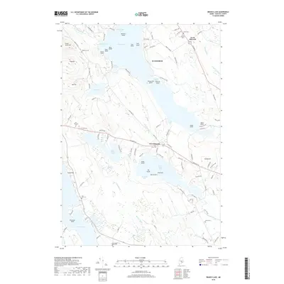
2018 Map of Branch Lake
USGS Topo · Published 2018About this map
Branch Lake and its intricate shoreline of coves and islands dominate this Hancock County landscape, where the settlements of North Ellsworth and West Ellsworth serve as local anchors. The map reveals a high density of small family and community burial grounds, including Nicolin Cem, Happytown Cem, and the Dorr Thompson Cem, which reflect the long-standing genealogical roots of this area. The terrain transitions from the water's edge at Musquash Cove to the elevated heights of Flying Moose Mtn and Oak Hill. A complex network of local roads and "fire roads," such as Fire Rd 217, suggests a region defined by seasonal access and lakeside living. Between the larger bodies of water lie significant wetlands like Jesse Bog and Carlisle Meadow, illustrating the natural drainage patterns that feed into Lower Patten Pond and eventually southward.
Find a feature on this map
117 named features on this map. Tap any name to fly to it.
Don’t see what you’re looking for? This feature index may not catch every label — zoom into the map to look around manually.
Map Details
Editions of this 2018 Branch Lake Map
This is the sole edition of this map. No revisions or reprints were ever made.
Other maps of this area

1900 · Orland
USGS Topo · 1:62,500

1904 · Mount Desert
USGS Topo · 1:62,500

1904 · Bluehill
USGS Topo · 1:62,500

1905 · Penobscot Bay
USGS Topo · 1:125,000

1911 · Ellsworth
USGS Topo · 1:62,500

1940 · Ellsworth
USGS Topo · 1:62,500

1942 · Orland
USGS Topo · 1:62,500

1942 · Ellsworth
USGS Topo · 1:62,500

1942 · Mount Desert
USGS Topo · 1:62,500

1944 · Blue Hill
USGS Topo · 1:62,500