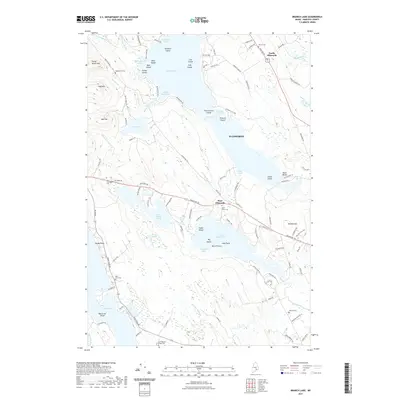
2021 Map of Branch Lake
USGS Topo · Published 2021About this map
Branch Lake dominates this Hancock County landscape, its irregular shoreline forming deep recesses such as Winkumpaugh Cove and Rocky Pond Cove. Numerous islands dot the water, including Teachers Island, Cow Island, and Snake Island, reflecting a glaciated terrain where ridges and water bodies follow a distinct northwest-to-southeast alignment. Small settlements like North Ellsworth and West Ellsworth are situated along primary corridors like Bangor Road and Bucksport Road, while the surrounding hills—Flying Moose Mountain, Flag Hill, and Oak Hill—anchor the upland areas.
Find a feature on this map
119 named features on this map. Tap any name to fly to it.
Don’t see what you’re looking for? This feature index may not catch every label — zoom into the map to look around manually.
Map Details
Editions of this 2021 Branch Lake Map
This is the sole edition of this map. No revisions or reprints were ever made.
Other maps of this area

1900 · Orland
USGS Topo · 1:62,500

1904 · Mount Desert
USGS Topo · 1:62,500

1904 · Bluehill
USGS Topo · 1:62,500

1905 · Penobscot Bay
USGS Topo · 1:125,000

1911 · Ellsworth
USGS Topo · 1:62,500

1940 · Ellsworth
USGS Topo · 1:62,500

1942 · Orland
USGS Topo · 1:62,500

1942 · Ellsworth
USGS Topo · 1:62,500

1942 · Mount Desert
USGS Topo · 1:62,500

1944 · Blue Hill
USGS Topo · 1:62,500