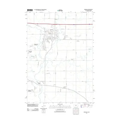
2012 Map of Brandon
USGS Topo · Published 2012About this map
Brandon serves as a central hub of development east of the Big Sioux River in this 2012 survey. The landscape reflects a shift from traditional rural hamlets to modern residential expansion, evidenced by the emerging Country Gables Subdivision and Indian Hill Division. Older community anchors remain visible, including the Bear Valley Lutheran Cem and the South Beaver Valley Cem, which provide valuable location data for genealogists tracking local families. The natural drainage of the region is defined by the winding course of Split Rock Cr and Beaver Cr, which carve through the plains toward Rowena and East Sioux Falls. These watercourses and their surrounding road networks, such as 480th Ave, illustrate the persistent grid that has shaped Minnehaha County's land use for generations.
Find a feature on this map
94 named features on this map. Tap any name to fly to it.
Don’t see what you’re looking for? This feature index may not catch every label — zoom into the map to look around manually.
Map Details
Editions of this 2012 Brandon Map
This is the sole edition of this map. No revisions or reprints were ever made.
Other maps of this area

1897 · Canton
USGS Topo · 1:125,000

1900 · Canton
USGS Topo · 1:125,000

1955 · Sioux Falls
USGS Topo · 1:250,000

1958 · Sioux Falls
USGS Topo · 1:250,000

1962 · Renner
USGS Topo · 1:24,000

1962 · Klondike
USGS Topo · 1:24,000

1962 · Harrisburg
USGS Topo · 1:24,000

1962 · Brandon
USGS Topo · 1:24,000

1962 · Sioux Falls East
USGS Topo · 1:24,000

1962 · Garretson West
USGS Topo · 1:24,000