
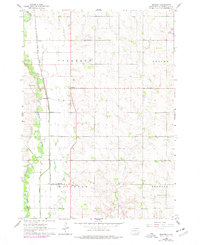
1962 Map of Renner
USGS Topo · Published 1964About this map
The Big Sioux River carves through the western edge of Minnehaha County, defining a landscape shaped by early agricultural settlement and water management. This early 1960s survey illustrates a region anchored by small rural hubs such as Renner and the nearby Renner Corner, where the Chicago Milwaukee St Paul and Pacific railroad parallels the river's course. The presence of the Old Diversion Ditch highlights historical efforts to control the river's flow through the townships of Sverdrup and Mapleton. Local heritage is deeply rooted in the numerous country churches and schools scattered across the prairie, including East Nidaros Ch and Bothun Sch. These markers, along with the Pioneer Cem, provide a clear view of the communal centers that sustained this farming district before significant suburban expansion reached northward from the regional center.
Find a feature on this map
19 named features on this map. Tap any name to fly to it.
Don’t see what you’re looking for? This feature index may not catch every label — zoom into the map to look around manually.
Map Details
Editions of this 1962 Renner Map
2 editions found
Other maps of this area

1955 · Sioux Falls
USGS Topo · 1:250,000

1958 · Sioux Falls
USGS Topo · 1:250,000

1962 · Colton SE
USGS Topo · 1:24,000

1962 · Dell Rapids
USGS Topo · 1:24,000

1962 · Brandon
USGS Topo · 1:24,000

1962 · Sioux Falls East
USGS Topo · 1:24,000

1962 · Garretson West
USGS Topo · 1:24,000

1962 · Sioux Falls West
USGS Topo · 1:24,000

1962 · Crooks
USGS Topo · 1:24,000
1972 · Dell Rapids SE
USGS Topo · 1:24,000