
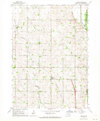
1962 Map of Crooks
USGS Topo · Published 1970About this map
Lyons and Crooks serve as the primary agricultural hubs in this corner of Minnehaha County, connected by the steel of the Burlington Northern railroad. The landscape is defined by the drainage patterns of Willow Creek and the meandering course of the Big Sioux River along the eastern edge. Local life is anchored by established community landmarks, including the West Nidaros Ch and Benton Ch, while the Lyons Cem provides a point of interest for those researching local family histories. The township boundaries of Lyons and Benton organize the grid of rural roads and farmsteads, reflecting the late mid-century settlement pattern just as regional transportation networks began to modernize with the addition of major thoroughfares seen in the 1971 photorevisions.
Find a feature on this map
10 named features on this map. Tap any name to fly to it.
Don’t see what you’re looking for? This feature index may not catch every label — zoom into the map to look around manually.
Map Details
Editions of this 1962 Crooks Map
2 editions found
Other maps of this area

1955 · Sioux Falls
USGS Topo · 1:250,000

1958 · Sioux Falls
USGS Topo · 1:250,000

1962 · Colton SE
USGS Topo · 1:24,000

1962 · Dell Rapids
USGS Topo · 1:24,000

1962 · Renner
USGS Topo · 1:24,000

1962 · Sioux Falls East
USGS Topo · 1:24,000

1962 · Hartford South
USGS Topo · 1:24,000

1962 · Hartford North
USGS Topo · 1:24,000

1962 · Sioux Falls West
USGS Topo · 1:24,000
1968 · Colton
USGS Topo · 1:24,000