
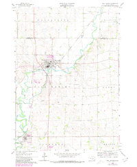
1962 Map of Dell Rapids
USGS Topo · Published 1963About this map
Dell Rapids serves as the focal point of this early 1960s survey, situated along a dramatic bend where the Big Sioux River carves through the landscape. The geography is defined by the Dells of the Sioux River, a prominent natural feature that influenced local development and industrial activity, evidenced by the nearby Quarry and Gravel Pits. The Chicago Milwaukee St Paul and Pacific railroad tracks trace the river's path, connecting the town to the broader agricultural prairie.
Find a feature on this map
29 named features on this map. Tap any name to fly to it.
Don’t see what you’re looking for? This feature index may not catch every label — zoom into the map to look around manually.
Map Details
Editions of this 1962 Dell Rapids Map
2 editions found
Other maps of this area

1955 · Sioux Falls
USGS Topo · 1:250,000

1958 · Sioux Falls
USGS Topo · 1:250,000

1962 · Colton SE
USGS Topo · 1:24,000

1962 · Renner
USGS Topo · 1:24,000

1962 · Garretson West
USGS Topo · 1:24,000

1962 · Crooks
USGS Topo · 1:24,000

1963 · Trent
USGS Topo · 1:24,000

1963 · Colman
USGS Topo · 1:24,000
1972 · Dell Rapids NE
USGS Topo · 1:24,000
1972 · Dell Rapids SE
USGS Topo · 1:24,000