
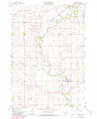
1963 Map of Trent
USGS Topo · Published 1964About this map
The Big Sioux River winds through the heart of Moody County, shaping the rural landscape between the rail towns of Egan and Trent. In the early 1960s, this area remained a critical corridor for the Chicago Milwaukee St Paul and Pacific railroad, which converges at Sioux Falls Junction. The river valley is punctuated by numerous Gravel Pits, indicating the importance of local mineral extraction to the regional economy.
Find a feature on this map
19 named features on this map. Tap any name to fly to it.
Don’t see what you’re looking for? This feature index may not catch every label — zoom into the map to look around manually.
Map Details
Editions of this 1963 Trent Map
2 editions found
Other maps of this area

1953 · Watertown
USGS Topo · 1:250,000

1955 · Sioux Falls
USGS Topo · 1:250,000

1958 · Sioux Falls
USGS Topo · 1:250,000

1958 · Watertown
USGS Topo · 1:250,000

1962 · Colton SE
USGS Topo · 1:24,000

1962 · Dell Rapids
USGS Topo · 1:24,000

1963 · Colman
USGS Topo · 1:24,000

1964 · Rutland SE
USGS Topo · 1:24,000

1964 · Flandreau SW
USGS Topo · 1:24,000
1972 · Dell Rapids NE
USGS Topo · 1:24,000