
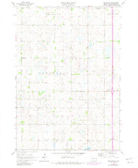
1964 Map of Rutland SE
USGS Topo · Published 1965About this map
A landscape of prairie depressions and low rises characterizes this corner of Moody County in the mid-1960s. The region is largely organized into civil townships including Fremont, Jefferson, and Riverview, where a grid of rural section roads links isolated family farms and community anchors. These social centers are small but vital, represented by locations such as the Whaley Sch and rural congregations at Wellman Ch and Midway Ch.
Find a feature on this map
13 named features on this map. Tap any name to fly to it.
Don’t see what you’re looking for? This feature index may not catch every label — zoom into the map to look around manually.
Map Details
Editions of this 1964 Rutland SE Map
2 editions found
Other maps of this area

1953 · Watertown
USGS Topo · 1:250,000

1955 · Sioux Falls
USGS Topo · 1:250,000

1958 · Sioux Falls
USGS Topo · 1:250,000

1958 · Watertown
USGS Topo · 1:250,000

1963 · Trent
USGS Topo · 1:24,000

1963 · Colman
USGS Topo · 1:24,000

1964 · Medary
USGS Topo · 1:24,000

1964 · Flandreau SW
USGS Topo · 1:24,000

1964 · Flandreau NW
USGS Topo · 1:24,000

1968 · Wentworth
USGS Topo · 1:24,000
Featured Places
- Fremont Township, SD
- Egan Township, SD
- Colman Township, SD
- Jefferson Township, SD
- Riverview Township, SD