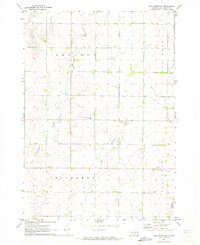
1972 Map of Dell Rapids NE
USGS Topo · Published 1973About this map
Grovena and Blinsmon townships anchor this 1970s survey of Moody County, which illustrates the structured agricultural grid and communal hubs of southeastern South Dakota. The landscape is defined by its rural heritage, anchored by local centers of faith and remembrance like the Swedish Augustana Cem, Trinity Ch, and Oslo Cem. These landmarks, along with the Messiah Cem, represent the early ethnic and religious settlements that shaped the social fabric of the plains.
Find a feature on this map
11 named features on this map. Tap any name to fly to it.
Don’t see what you’re looking for? This feature index may not catch every label — zoom into the map to look around manually.
Map Details
Editions of this 1972 Dell Rapids NE Map
This is the sole edition of this map. No revisions or reprints were ever made.
Other maps of this area

1953 · Watertown
USGS Topo · 1:250,000

1955 · Sioux Falls
USGS Topo · 1:250,000

1958 · Sioux Falls
USGS Topo · 1:250,000

1958 · Watertown
USGS Topo · 1:250,000

1962 · Dell Rapids
USGS Topo · 1:24,000

1963 · Trent
USGS Topo · 1:24,000

1964 · Flandreau SW
USGS Topo · 1:24,000

1967 · Elkton SW
USGS Topo · 1:24,000

1967 · Jasper
USGS Topo · 1:24,000

1967 · Jasper NW
USGS Topo · 1:24,000
Featured Places
- Blinsmon Township, SD
- Lone Rock Township, SD
- Grovena Township, SD
- Alliance Township, SD
- Moody County, SD