
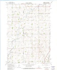
1967 Map of Jasper NW
USGS Topo · Published 1968About this map
Pipestone Creek winds through the agricultural landscape of the upper Midwest in the late 1960s, cutting across the border shared by South Dakota and Minnesota. This survey captures a rural landscape defined by township organization and localized community hubs, including the Lone Rock settlement area. The map reveals the placement of essential local institutions such as Lone Rock Ch, Salem Ch, and the Eden Cem, which served the surrounding farming families.
Find a feature on this map
16 named features on this map. Tap any name to fly to it.
Don’t see what you’re looking for? This feature index may not catch every label — zoom into the map to look around manually.
Map Details
Editions of this 1967 Jasper NW Map
2 editions found
Other maps of this area

1953 · Watertown
USGS Topo · 1:250,000

1955 · Sioux Falls
USGS Topo · 1:250,000

1958 · Sioux Falls
USGS Topo · 1:250,000

1958 · Watertown
USGS Topo · 1:250,000

1967 · Pipestone North
USGS Topo · 1:24,000

1967 · Elkton SW
USGS Topo · 1:24,000

1967 · Jasper SE
USGS Topo · 1:24,000

1967 · Pipestone South
USGS Topo · 1:24,000

1967 · Jasper
USGS Topo · 1:24,000
1972 · Dell Rapids NE
USGS Topo · 1:24,000