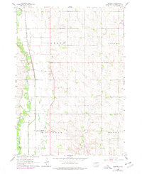
1962 Map of Renner
USGS Topo · Published 1977About this map
Big Sioux River and its meandering tributaries, including Silver Creek and Slip-up Creek, define the landscape of Minnehaha County in the early 1960s. The settlement at Renner serves as a focal point for the surrounding rural townships of Sverdrup, Edison, Mapleton, and Brandon. This agricultural territory is anchored by long-standing community institutions such as East Nidaros Ch, Swedona Covenant Ch, and Bothun Sch.
Find a feature on this map
19 named features on this map. Tap any name to fly to it.
Don’t see what you’re looking for? This feature index may not catch every label — zoom into the map to look around manually.
Map Details
Editions of this 1962 Renner Map
2 editions found
Other maps of this area

1955 · Sioux Falls
USGS Topo · 1:250,000

1958 · Sioux Falls
USGS Topo · 1:250,000

1962 · Colton SE
USGS Topo · 1:24,000

1962 · Dell Rapids
USGS Topo · 1:24,000

1962 · Renner
USGS Topo · 1:24,000

1962 · Brandon
USGS Topo · 1:24,000

1962 · Sioux Falls East
USGS Topo · 1:24,000

1962 · Garretson West
USGS Topo · 1:24,000

1962 · Sioux Falls West
USGS Topo · 1:24,000

1962 · Crooks
USGS Topo · 1:24,000