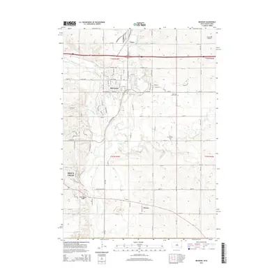
2015 Map of Brandon
USGS Topo · Published 2015About this map
Brandon and the surrounding prairie lands east of Sioux Falls are defined by the winding course of the Big Sioux River and its many tributaries. The landscape is structured by a rigorous grid of section lines and township boundaries, including t102n r48w, which organize the agricultural and residential development of the region. Notable watercourses like Split Rock Cr and Beaver Cr cut through the terrain, while the northeastern corner shows the rising elevation of the Coteau des Prairies plateau. Small communities such as Corson and Rowena maintain their distinct footprints away from the expanding suburban core. Local heritage is preserved in several burial grounds, including the Brandon Cem, Bear Valley Lutheran Cem, and South Beaver Valley Cem, which serve as vital landmarks for genealogists tracing the early settlement patterns of Minnehaha County.
Find a feature on this map
37 named features on this map. Tap any name to fly to it.
Don’t see what you’re looking for? This feature index may not catch every label — zoom into the map to look around manually.
Map Details
Editions of this 2015 Brandon Map
This is the sole edition of this map. No revisions or reprints were ever made.
Other maps of this area

1897 · Canton
USGS Topo · 1:125,000

1900 · Canton
USGS Topo · 1:125,000

1955 · Sioux Falls
USGS Topo · 1:250,000

1958 · Sioux Falls
USGS Topo · 1:250,000

1962 · Renner
USGS Topo · 1:24,000

1962 · Klondike
USGS Topo · 1:24,000

1962 · Harrisburg
USGS Topo · 1:24,000

1962 · Brandon
USGS Topo · 1:24,000

1962 · Sioux Falls East
USGS Topo · 1:24,000

1962 · Garretson West
USGS Topo · 1:24,000