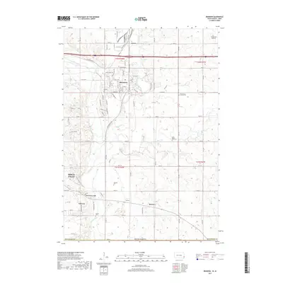
2017 Map of Brandon
USGS Topo · Published 2017About this map
Brandon and the surrounding prairie landscape are defined by the convergence of several waterways, including the Big Sioux River and Split Rock Creek. The area south of the high ground at Coteau des Prairies shows a detailed network of section-line roads and rural settlements like Rowena, Corson, and Anderson. Significant genealogical data is present through numerous burial grounds, such as Beaver Valley Lutheran Cem and Hokenson Cem, which anchor the farming communities east of Sioux Falls. The layout of East Sioux Falls and the presence of Railroad Ave in Corson illustrate the historical importance of transportation corridors that followed the river valleys through Minnehaha County. This survey provides a clear view of the suburban and agricultural patterns before the further expansion of the metropolitan area.
Find a feature on this map
88 named features on this map. Tap any name to fly to it.
Don’t see what you’re looking for? This feature index may not catch every label — zoom into the map to look around manually.
Map Details
Editions of this 2017 Brandon Map
This is the sole edition of this map. No revisions or reprints were ever made.
Other maps of this area

1897 · Canton
USGS Topo · 1:125,000

1900 · Canton
USGS Topo · 1:125,000

1955 · Sioux Falls
USGS Topo · 1:250,000

1958 · Sioux Falls
USGS Topo · 1:250,000

1962 · Renner
USGS Topo · 1:24,000

1962 · Klondike
USGS Topo · 1:24,000

1962 · Harrisburg
USGS Topo · 1:24,000

1962 · Brandon
USGS Topo · 1:24,000

1962 · Sioux Falls East
USGS Topo · 1:24,000

1962 · Garretson West
USGS Topo · 1:24,000