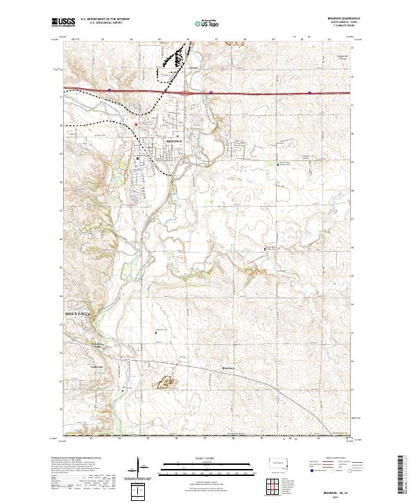
2021 Map of Brandon
USGS Topo · Published 2021About this map
Split Rock Creek winds through the heart of this landscape, carving a path through the Coteau des Prairies as it flows south toward the Big Sioux River. This 2021 survey illustrates the modern expansion of Brandon, showing how residential streets like Ponderosa Dr and Custer Pkwy have integrated into the prairie terrain. The map is a vital resource for genealogists, documenting several local burial grounds including the Beaver Valley Lutheran Cem, Hokenson Cem, and Monson Cem. While Brandon serves as the primary hub, smaller settlements such as Corson, Rowena, and East Sioux Falls provide a broader view of the region's historical community centers. Outdoor recreation is prominently featured through the Jay Heath Canoe & Kayak Trl and the Big Sioux Bike Trl, which follow the natural contours of the river valleys.
Find a feature on this map
70 named features on this map. Tap any name to fly to it.
Don’t see what you’re looking for? This feature index may not catch every label — zoom into the map to look around manually.
Map Details
Editions of this 2021 Brandon Map
This is the sole edition of this map. No revisions or reprints were ever made.
Other maps of this area

1897 · Canton
USGS Topo · 1:125,000

1900 · Canton
USGS Topo · 1:125,000

1955 · Sioux Falls
USGS Topo · 1:250,000

1958 · Sioux Falls
USGS Topo · 1:250,000

1962 · Renner
USGS Topo · 1:24,000

1962 · Klondike
USGS Topo · 1:24,000

1962 · Harrisburg
USGS Topo · 1:24,000

1962 · Brandon
USGS Topo · 1:24,000

1962 · Sioux Falls East
USGS Topo · 1:24,000

1962 · Garretson West
USGS Topo · 1:24,000