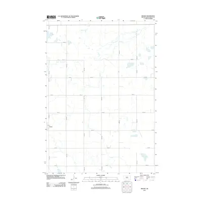
2012 Map of Brandt
USGS Topo · Published 2012About this map
Brandt sits at the western edge of this Deuel County landscape, defined by a rigid grid of rural roads and a complex network of prairie waterways. The town's small street plan, including Madison St and Elm St, serves as a localized anchor for the surrounding agricultural sections. Natural drainage patterns dominate the terrain, notably the winding courses of Cobb Cr and its northern branch, N Br Cobb Cr. To the southeast, the geography transitions into significant wetlands and standing water, with Fox Lake and Cottonwood Slough marking the low-lying areas. This 2012 survey illustrates the persistence of the section-line road system, where corridors like 479th Ave and 187th St dictate the movement across the glacial till. The map provides a clear record of the relationship between the built environment of Brandt and the hydrological features that shape the eastern South Dakota plains.
Find a feature on this map
21 named features on this map. Tap any name to fly to it.
Don’t see what you’re looking for? This feature index may not catch every label — zoom into the map to look around manually.
Map Details
Editions of this 2012 Brandt Map
This is the sole edition of this map. No revisions or reprints were ever made.
Other maps of this area

1953 · Watertown
USGS Topo · 1:250,000

1958 · Watertown
USGS Topo · 1:250,000

1967 · Gary
USGS Topo · 1:24,000

1967 · Canby NW
USGS Topo · 1:24,000

1967 · Hendricks
USGS Topo · 1:24,000

1970 · Brandt
USGS Topo · 1:24,000

1970 · Astoria
USGS Topo · 1:24,000

1970 · Clear Lake South
USGS Topo · 1:24,000

1970 · Toronto
USGS Topo · 1:24,000
1973 · Lake Francis
USGS Topo · 1:24,000