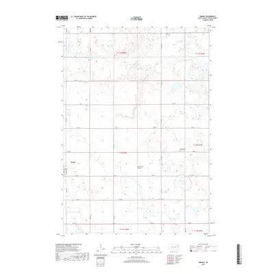
2017 Map of Brandt
USGS Topo · Published 2017About this map
Brandt sits at the heart of this Deuel County landscape, which is defined by the unique glaciated topography of the Coteau des Prairies. This high plateau, rising above the surrounding plains, is characterized here by numerous glacial wetlands and small water bodies, including Fox Lake and the Cottonwood Slough. The local drainage pattern is dominated by Cobb Cr and its northern branch, N Br Cobb Cr, which meander through a grid of section lines and gravel roads. In the eastern portion of the quadrangle, the East Highland Lutheran Cem serves as a significant landmark for genealogists and local historians tracing the heritage of this rural community. The map provides a detailed view of the town of Brandt, showing its primary thoroughfares like Jefferson St and Madison St, reflecting the persistent agricultural and settlement patterns of this corner of South Dakota.
Find a feature on this map
30 named features on this map. Tap any name to fly to it.
Don’t see what you’re looking for? This feature index may not catch every label — zoom into the map to look around manually.
Map Details
Editions of this 2017 Brandt Map
This is the sole edition of this map. No revisions or reprints were ever made.
Other maps of this area

1953 · Watertown
USGS Topo · 1:250,000

1958 · Watertown
USGS Topo · 1:250,000

1967 · Gary
USGS Topo · 1:24,000

1967 · Canby NW
USGS Topo · 1:24,000

1967 · Hendricks
USGS Topo · 1:24,000

1970 · Brandt
USGS Topo · 1:24,000

1970 · Astoria
USGS Topo · 1:24,000

1970 · Clear Lake South
USGS Topo · 1:24,000

1970 · Toronto
USGS Topo · 1:24,000
1973 · Lake Francis
USGS Topo · 1:24,000