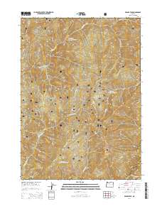
2014 Map of Brandy Peak
USGS Topo · Published 2014About this map
Brandy Peak stands as the prominent landmark within this 2014 survey of the Siskiyou National Forest along the border of Curry and Josephine Counties. The landscape is defined by its dramatic elevation changes, from the heights of Squirrel Peak and Sugarloaf Mtn down to the drainage basins of the Shasta Costa Cr and Indigo Cr. While largely timberland, the map identifies small, relatively level openings in the forest canopy such as Whitten Prairie and Indigo Prairie. These meadows, along with Indian Flat, represent rare breaks in the dense topography where early travel and small-scale activities were concentrated. A network of Forest Service infrastructure supports the area, including Nat For Dev Rd 23 and Nat For Dev Rd 2308, which follow the contours of landforms like Burnt Ridge to provide access to these remote peaks and watersheds.
Find a feature on this map
27 named features on this map. Tap any name to fly to it.
Don’t see what you’re looking for? This feature index may not catch every label — zoom into the map to look around manually.
Map Details
Editions of this 2014 Brandy Peak Map
This is the sole edition of this map. No revisions or reprints were ever made.
Other maps of this area

1899 · Port Orford
USGS Topo · 1:125,000

1903 · Port Orford
USGS Topo · 1:125,000

1917 · Kerby
USGS Topo · 1:125,000

1918 · Kerby
USGS Topo · 1:125,000

1945 · Kerby
USGS Topo · 1:125,000

1954 · Coos Bay
USGS Topo · 1:250,000

1954 · Marial
USGS Topo · 1:62,500

1954 · Collier Butte
USGS Topo · 1:62,500

1954 · Agness
USGS Topo · 1:62,500

1954 · Pearsoll Peak
USGS Topo · 1:62,500